DLL with coordinate transformations and more
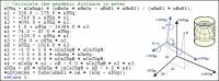
GeoDLL supports the development of geodetic software on various platforms by providing geodetic functions. GeoDLL contains precise calculations on the themes 2D and 3D coordinate transformation, geodetic datum shift and reference system converting, meridian strip changing, user defined coordinate and reference systems, distance calculations, Digital Elevation Model, NTv2 handling and BeTA2007 support, Direct / Inverse solutions, map function and geodetic converting functions. The most important application of GeoDLL is to include professional coordinate transformations in own programs. These coordinate and reference systems are supported: 1. The current and many historical coordinate and reference systems of all countries of the European Union (EU) including the eastern extensions and the systems of the European non-EU countries. 2. The European ETRS89 systems forced by INSPIRE with respect to the continental drift. 3 .The US and Canadian State Plane Coordinate Systems (SPCS) and other systems of the North American continent. 4. Many coordinate and reference systems of the countries of all continents and the world-wide used coordinate and reference systems. 5. World-wide NTv2 grid file supported coordinate transformations. 6. The coordinate and reference systems of the old and new German Federal States, the 40 Prussian Soldner Land Registers, the German 'Lagestatus', special reference systems of the German Federal States and BeTA2007. 7. User defined coordinate systems, reference systems and earth ellipsoids. GeoDLL comes with extensive documentation and is supplied as DLL file or as C++ source code for 32bit and 64bit architectures. The DLL works with most programming languages and it can be used with Microsoft Office programs. The DLL is written in C++ and was developed with Microsoft Visual Studio 2010. Thus very fast performance, compact code and high stability are assured. The functions of GeoDLL are prepared for multithreading.
Operating system:Windows 8, Windows 7, Windows Vista, Windows XP, Windows 2000, Windows 98

ActiveX Charting Control offers hundreds of Graph styles in 2D and 3D, 33 mathematical and statistical Functions for you to choose from together with an unlimited number of axes and 17 toolbox components. For Windows and the Web.
Price: $449, Rating: 7, Downloads: 170
Download

The Chilkat C++ class library for VC++ 7.0 fully supports SMTP, POP3, MIME, HTML, SSL, S/MIME, secure authentication, attachments, SSL, progress monitoring, zip and unzip of attachments, XML import/export, and is fully internationalized to handle email in
Price: $99, Rating: 8, Downloads: 152
Download

Object-Oriented Charting component library completely written in PHP and ready to be used in any PHP scripts. It includes full source code meaning that no loaders have to be used in order to create a Graph on servers.
Price: $, Rating: 8, Downloads: 151
Download

OPC DA .NET Server Toolkit
Price: $0, Rating: 5.5, Downloads: 147
Download

In short, Colock is a software based lock for making your software copy protected. By adding just one line of code to source code of your program, you will be able to use powerful copy protection system of Colock.
Price: $45.00, Rating: 8, Downloads: 137
Download